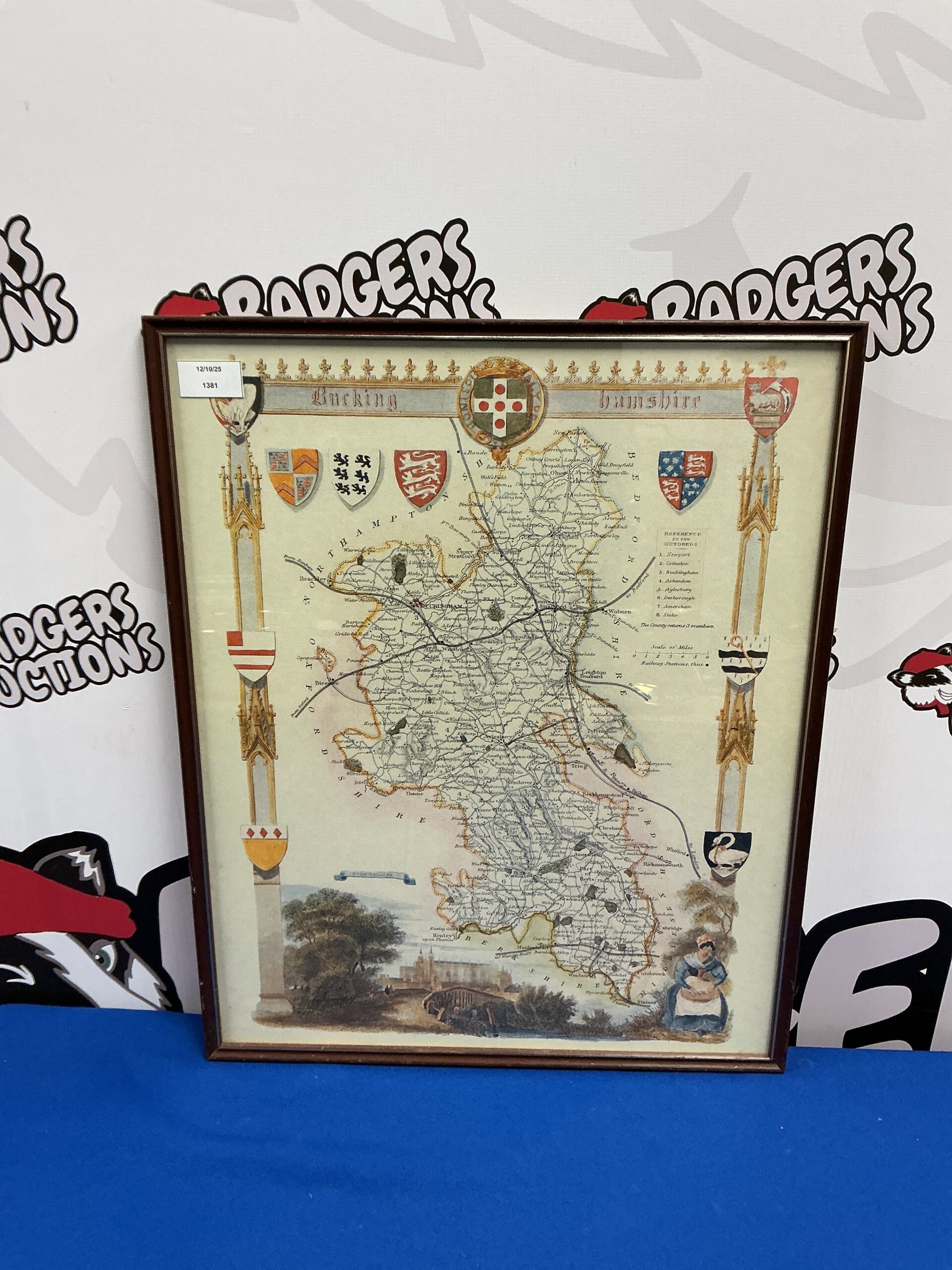
Antique Buckinghamshire County Map
This is a beautifully detailed antique map of Buckinghamshire, likely dating from the 19th century. The map showcases the county’s topography, towns, villages, and transportation networks with intricate linework and a classic aesthetic. It is presented within a decorative frame, enhancing its visual appeal and making it ready for display.
Condition and Collectibility
The map exhibits signs of age and wear consistent with its antique status, including some foxing and minor imperfections. These characteristics contribute to its authenticity and charm. This map would be a desirable addition to a collection of antique maps, county history, or topographical prints, appealing to collectors and enthusiasts alike.