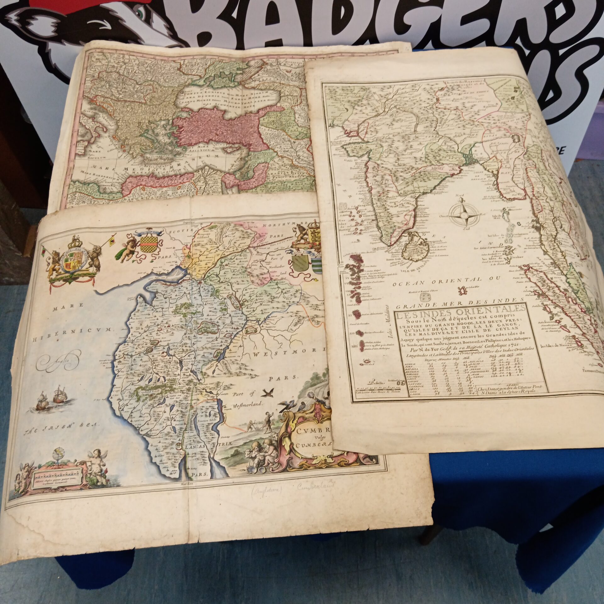
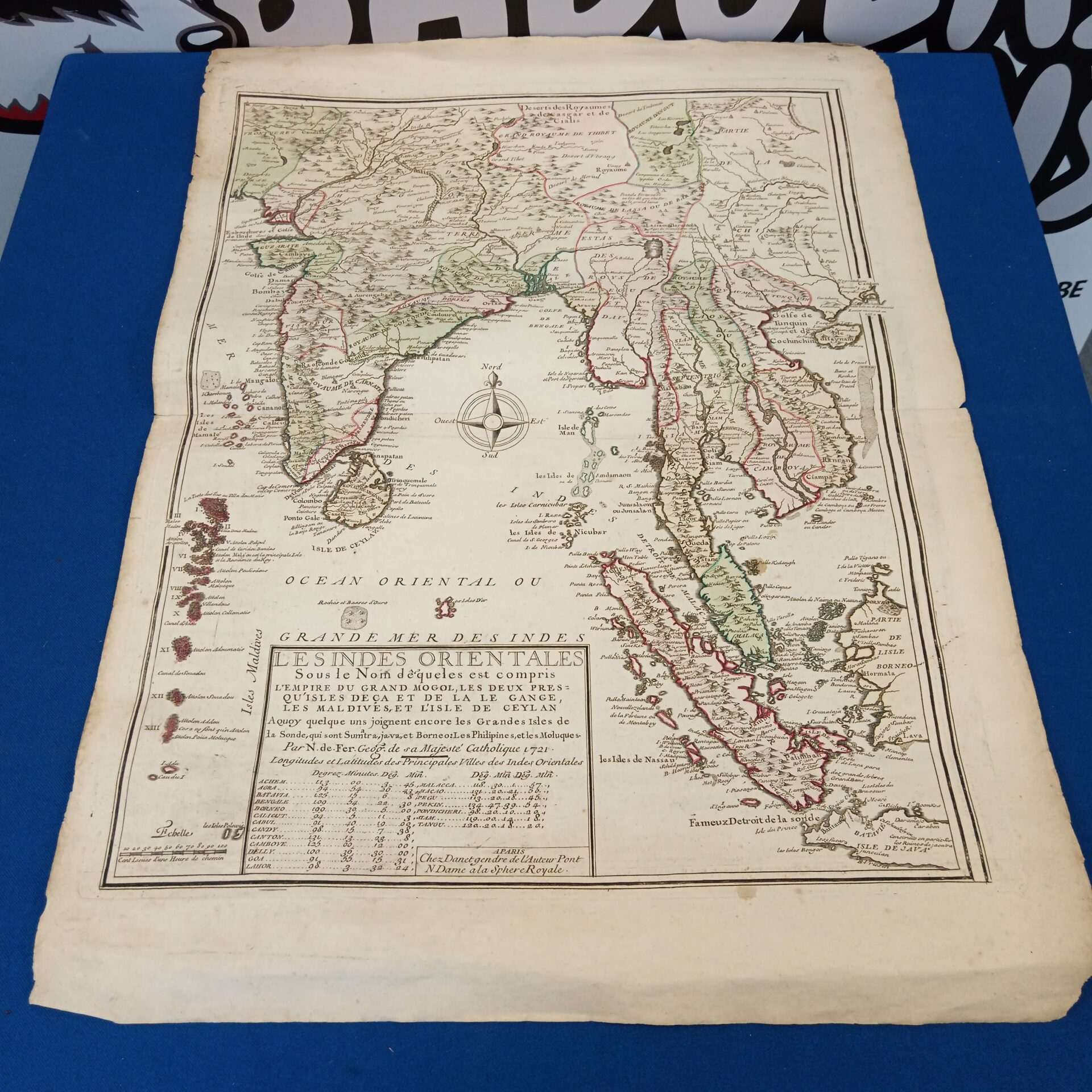
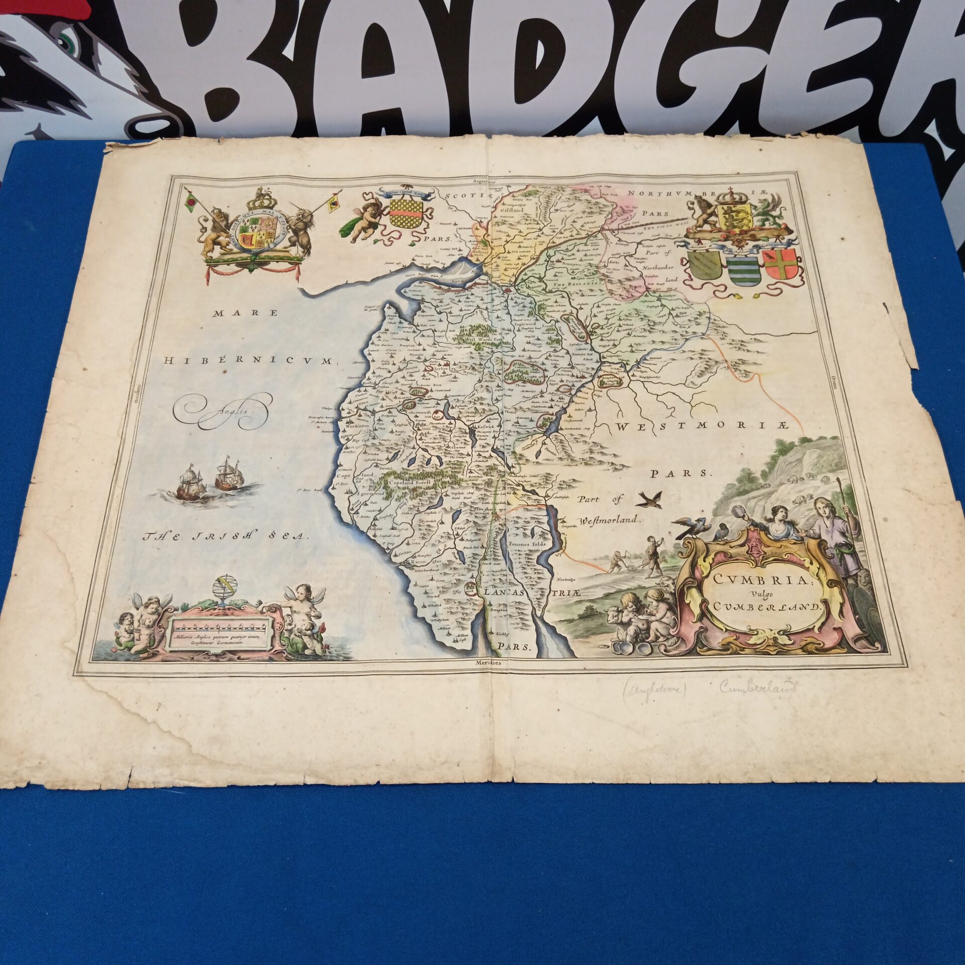
Antique World Map Collection
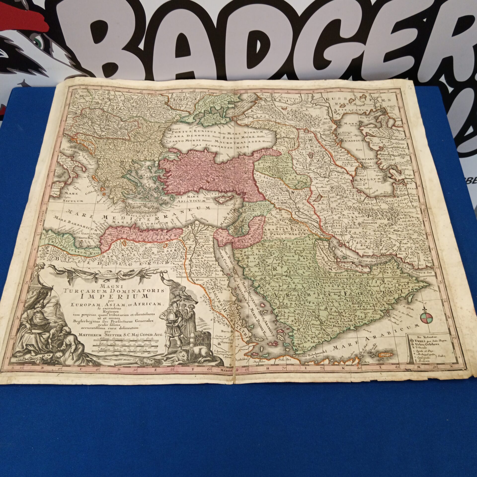
This lot comprises three fascinating antique maps, offering a glimpse into the cartographic understanding of the 17th century. The collection features a detailed map of Persia (likely depicting the Mughal Empire), a map of Cumbria in England, and a broader world map showcasing the known continents and seas of the era. These maps are beautifully hand-coloured, displaying intricate details of coastlines, cities, and geographical features, and are likely intended for scholarly or navigational purposes.
Condition and Collectibility
These maps exhibit signs of age and wear, including some foxing, minor tears, and creasing, which are consistent with their age and add to their character. Despite these imperfections, the maps remain remarkably well-preserved, retaining their vibrant colours and intricate details. They are highly collectible items, appealing to enthusiasts of historical cartography, collectors of antique maps, and those interested in the history of exploration and geographical knowledge.